Map - Umuarama

Umuarama
Umuarama is a municipality in the state of Paraná in Brazil. Its population was 112,500 inhabitants in 2020. Umuarama is one of the most important cities in Paraná, one of the three states of southern Brazil. The city elevation is 430 m (1,300 feet) above sea level and the rainfall is about 1600mm/year (63 inches/yr). Umuarama is known as "The Capital of Friendship".

The municipality was founded in 1955, and colonized by Companhia Melhoramentos Norte do Paraná, a company that settled an important number of cities in Northern Paraná.
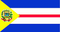
 
Map - Umuarama
Map
Google Earth - Map - Umuarama
Google Earth
Openstreetmap - Map - Umuarama
Openstreetmap
Map - Umuarama - Esri.WorldImagery
Esri.WorldImagery
Map - Umuarama - Esri.WorldStreetMap
Esri.WorldStreetMap
Map - Umuarama - OpenStreetMap.Mapnik
OpenStreetMap.Mapnik
Map - Umuarama - OpenStreetMap.HOT
OpenStreetMap.HOT
Map - Umuarama - OpenTopoMap
OpenTopoMap
Map - Umuarama - CartoDB.Positron
CartoDB.Positron
Map - Umuarama - CartoDB.Voyager
CartoDB.Voyager
Map - Umuarama - OpenMapSurfer.Roads
OpenMapSurfer.Roads
Map - Umuarama - Esri.WorldTopoMap
Esri.WorldTopoMap
Map - Umuarama - Stamen.TonerLite
Stamen.TonerLite
Country - Brazil
Currency / Language  
ISO Currency Symbol Significant figures
BRL Brazilian real R$ 2
Neighbourhood - Country  
  •  Argentina 
  •  Bolivia 
  •  Colombia 
  •  French Guiana 
  •  Guyana 
  •  Paraguay 
  •  Peru 
  •  Suriname 
  •  Uruguay 
  •  Venezuela 
Administrative Subdivision
City, Village,...